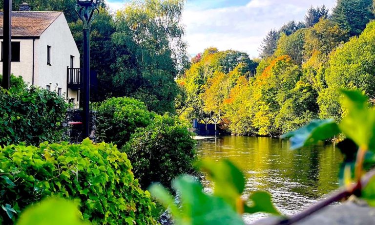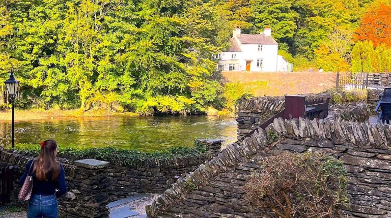
Newby Bridge sits at the foot of Windermere, with riverside paths, woodland and open fell within easy reach.
These seven walks range from a short lakeside loop to longer days on Cartmel Fell, Whitbarrow and the lanes towards Cartmel. Each one includes an interactive map, plus distance, ascent, time and practical notes so you can choose a route that fits the day.
Related: The Best 7 Walks from Backbarrow · Things to Do in Newby Bridge
Quick comparison:
| Walk | Distance | Time | Difficulty | Start |
|---|---|---|---|---|
| Fell Foot Park | about 2.9 km | about 45 min–1 hour | Easy | Fell Foot Park |
| Sow How Tarn & Raven’s Barrow | 7.97 km | about 2 hours 20 min | Moderate | Cartmel Fell |
| Whitbarrow Scar circular | about 7.4 km | about 2.5–3 hours | Moderate | Witherslack / Whitbarrow |
| Cartmel & Hampsfell | about 8.8–8.9 km | about 2.5 hours | Moderate | Cartmel |
| Newby Bridge circular | about 9.0 km | about 3–3.5 hours | Moderate | Newby Bridge / Colton area |
| Raven’s Barrow & Gummer’s How | 9.28 km | about 2 hours 50 min | Moderate | Cartmel Fell |
| Newby Bridge to Cartmel | about 13.5 km | about 4–4.5 hours | Moderate | Newby Bridge (finishes Cartmel) |
Jump to a walk (7)
Fell Foot Park
About 7 minutes by car from the Dolly Blue Bar
Fell Foot Park sits on the south-east shore of Windermere.
This short loop stays on park and lakeshore paths, with open grass, trees and lake views rather than a fell climb.
It suits a gentle outing, a warm-up before a longer walk, or time by the water with children. Paths can be muddy after rain.
Difficulty: Easy
Best for: Families, short outings, lake views
Distance: about 2.9 km (AllTrails widget)
Ascent: low (park-level; widget elevation stays around 40–60 m)
Time: about 45 minutes to 1 hour (guide based on distance)
Start point: Fell Foot Park, Newby Bridge area
Terrain: Park paths and lakeshore; can be muddy
Parking: National Trust Fell Foot car park (charges usually apply for non-members — check signs on arrival)
Dog-friendly: National Trust site rules apply — check locally for lead restrictions and livestock on adjoining land
Sow How Tarn and Raven’s Barrow
About 15 minutes by car from the Dolly Blue Bar
This Cartmel Fell circuit takes in Sow How Tarn and the viewpoint at Raven’s Barrow without needing to climb Gummer’s How.
You get open hillside, woodland and a clear sense of height above the Winster valley.
Komoot rates it moderate. Paths are mostly straightforward, but the ground can be wet, and livestock is common.
Difficulty: Moderate
Best for: Views, a half-day without the busiest Windermere summits
Distance: 7.97 km
Ascent: 210 m
Time: about 2 hours 20 minutes
Start point: Cartmel Fell (near St Anthony’s Church / Height Road area)
Terrain: Fell and woodland paths; can be muddy; livestock likely
Parking: Limited roadside parking near Cartmel Fell — do not block gates or drives
Dog-friendly: Not clearly stated on the source map — keep dogs on a lead around livestock and follow any on-site signs
Whitbarrow Scar circular
About 15 minutes by car from the Dolly Blue Bar
Whitbarrow is a limestone scar east of the Lyth Valley, with pale rock, open tops and wide views on a clear day.
This circular Plotaroute walk stays in the Witherslack / Whitbarrow area and feels different from the Windermere shore paths.
Limestone can be slippery when wet. Boots with decent grip help.
Difficulty: Moderate
Best for: Views, a change of scenery from the lake
Distance: 4.608 miles (about 7.4 km)
Ascent: 790 ft (about 241 m)
Time: about 2.5 to 3 hours (guide based on distance and ascent)
Start point: Witherslack / Whitbarrow area (follow the map embed)
Terrain: Limestone paths and open scar; can be slippery when wet
Parking: Local roadside/reserve parking — check National Nature Reserve notices on arrival
Dog-friendly: On nature reserve land, follow on-site rules; leads are the sensible default around livestock and ground-nesting birds
Cartmel and Hampsfell
About 15 minutes by car from the Dolly Blue Bar
From Cartmel the path climbs to Hampsfell and the small hospice building on the summit, with a viewpoint on the roof on a clear day. The circular continues through woodland (including Heaning Wood) before dropping back towards the village.
The ascent steepens as you gain height. Mud is common after wet weather, and sheep graze parts of the hill.
Difficulty: Moderate
Best for: Views, a village start and finish
Distance: about 8.8 to 8.9 km
Ascent: about 267 m
Time: about 2.5 hours
Start point: Cartmel
Terrain: Grassland, woodland and a steeper climb to the hospice; muddy sections after rain
Parking: Cartmel village car parks (pay) — spaces fill at busy times
Dog-friendly: Livestock on the hill — keep dogs on a lead and follow local guidance
Newby Bridge circular
About 3 minutes by car from the Dolly Blue Bar
This hilly circular is a user-plotted walking route on Plotaroute, starting in the Newby Bridge / Colton area.
It is listed as mostly off-road and gives a proper local loop without repeating the High Dam or Finsthwaite circuits covered on other pages.
Because it is a community-plotted line rather than an official waymarked trail, treat the map as a guide.
Stay on signed public footpaths and bridleways, carry OS Explorer OL7, and turn back if any stretch looks private, overgrown or unclear.
Difficulty: Moderate
Best for: A local hill circuit close to Newby Bridge
Distance: 5.613 miles (about 9.0 km)
Ascent: 1167 ft (about 356 m)
Time: about 3 to 3.5 hours (guide based on distance and ascent)
Start point: Newby Bridge / Colton area (follow the map embed)
Terrain: Mostly off-road paths and tracks on the source listing; expect mud and some road links — confirm on the ground
Parking: Limited local parking around Newby Bridge — use public car parks where available and avoid blocking drives
Dog-friendly: Not stated on the source page — leads around livestock and on lanes
Raven’s Barrow and Gummer’s How
About 15 minutes by car from the Dolly Blue Bar
From Cartmel Fell, this moderate loop links Raven’s Barrow with Gummer’s How, the familiar viewpoint above Windermere’s southern shore.
It is a longer day than the short Gummer’s How circuit from Fell Foot Brow, with more time on open ground between the two tops.
Komoot notes parking next to the start. Paths are generally accessible, but the climbs are steady, and the ground can be rough when wet.
Difficulty: Moderate
Best for: Views over Windermere and Cartmel Fell
Distance: 9.28 km
Ascent: 300 m
Time: about 2 hours 50 minutes
Start point: Cartmel Fell (parking noted beside the Komoot start)
Terrain: Fell and woodland paths; some steeper ground; livestock likely
Parking: Limited parking at/near the start — arrive early at weekends
Dog-friendly: Often walked with dogs in this area; keep leads handy for sheep and busy parking spots
Newby Bridge to Cartmel
About 3 minutes by car from the Dolly Blue Bar to the start
This linear Plotaroute walk runs from the Newby Bridge area south to Cartmel, roughly 8.4 miles. It is a fuller day on mixed ground, finishing in a village with pubs and cafés.
Return transport: There is no simple direct bus listed between Newby Bridge and Cartmel on bustimes.org.
Newby Bridge is served by Stagecoach services on the Kendal–Ulverston corridor (routes 6, 6C and X6) and by the Lakeside & Haverthwaite Railway between Lakeside, Newby Bridge and Haverthwaite.
Cartmel is served by Stagecoach 530 (Kendal–Cartmel) and Blueworks 532 (Cartmel–Grange-over-Sands).
Connecting journeys change with the timetable — check bustimes.org or Traveline before you rely on a bus home.
Many walkers leave a second car in Cartmel, book a taxi, or walk the route only when they have a lift arranged.
Difficulty: Moderate
Best for: A longer linear day with a village finish
Distance: 8.408 miles (about 13.5 km), A to B
Ascent: 1138 ft (about 347 m)
Time: about 4 to 4.5 hours walking (guide based on distance and ascent; allow extra for breaks and the return plan)
Start point: Newby Bridge area (finishes in Cartmel)
Terrain: Mixed paths and lanes on a user-plotted line — stay on public rights of way and check the map as you go
Parking: Start near Newby Bridge public parking; finish near Cartmel village car parks if you are collecting a car
Dog-friendly: Not stated on the source page — leads on lanes and around livestock
Getting There: Parking and Public Transport
Most of these walks are a short drive from Lakeland Village / Backbarrow. Fell Foot and the Newby Bridge starts are the closest; Cartmel Fell, Whitbarrow and Cartmel village need a little longer on local roads.
For buses, Newby Bridge has stops by the Swan Hotel and the Whitewater Hotel area, with Stagecoach services on the Kendal–Ulverston corridor (6, 6C, X6) listed on bustimes.org.
The Lakeside & Haverthwaite Railway links Lakeside, Newby Bridge Halt and Haverthwaite when trains are running. Cartmel has local services towards Kendal and Grange-over-Sands. Always check current times before you travel — rural services change by season and day of week.
Car parks at Fell Foot (National Trust) and in Cartmel usually charge. Roadside parking near Cartmel Fell and Whitbarrow is limited; never block field gates.
Seasonal Tips
- After rain, expect mud on woodland and farm paths, and slippery limestone on Whitbarrow.
- Summer weekends fill the Fell Foot and Gummer’s How car parks early — arrive sooner or pick a quieter start.
- Late spring brings bluebells in many of the woods around Finsthwaite and the Leven valley.
- In winter, daylight is short on the longer routes (Whitbarrow, Raven’s Barrow loops, Newby Bridge to Cartmel). Set off with a torch in the bag.
- Livestock and nesting birds mean leads are often required even on popular paths.
Where to Stay
If you need a base for walking around Newby Bridge and Backbarrow, the Whitewater Hotel sits in Lakeland Village beside the River Leven.
Rooms overlook the river or grounds, and Cascades Spa is on site if you want a swim or treatment after a day on the paths.
Click here for hotel accommodation at the Whitewater Hotel
FAQ
What are the best easy walks near Newby Bridge?
Fell Foot Park is the gentlest option on this list. For a longer but still manageable day with a village finish, many people choose Cartmel and Hampsfell when they are happy with a moderate climb.
Can I walk from Newby Bridge without a car?
You can reach Newby Bridge itself by Stagecoach services on the Kendal–Ulverston corridor and, seasonally, by the Lakeside & Haverthwaite Railway.
From the village, the Newby Bridge circular and the linear walk towards Cartmel start closest. Cartmel Fell, Whitbarrow and Hampsfell are much easier with a car or a lift.
Are Newby Bridge walks dog-friendly?
Many local paths are walked with dogs, but livestock is common on fell and farmland. Use a lead unless signs clearly allow otherwise, and check National Trust rules at Fell Foot.
Where should I park for walks near Newby Bridge?
Use the National Trust car park at Fell Foot for the lakeshore loop, public parking around Newby Bridge for the local circular and the Cartmel linear start, and village car parks in Cartmel for Hampsfell. Cartmel Fell and Whitbarrow rely on limited roadside spaces.
How hard are Whitbarrow and Cartmel Fell from Newby Bridge?
Both are moderate: expect several kilometres and a few hundred metres of ascent. Whitbarrow adds limestone underfoot; Cartmel Fell and Raven’s Barrow add open hillside that can be wet and windy.
What is the best walk for views over Windermere near Newby Bridge?
Raven’s Barrow and Gummer’s How is the clearest Windermere viewpoint on this list. Fell Foot Park gives lake views with far less climbing.
Final Notes on Walking Around Newby Bridge
Check the weather and path conditions before you set out, and leave enough daylight for the longer routes. On farmland and open fell, close gates and give livestock space.
When you are ready for food and drink afterwards, the Dolly Blue Bar serves relaxed meals and drinks beside the River Leven, and the Riverside Restaurant at the Whitewater Hotel offers a fuller menu for an evening meal.